


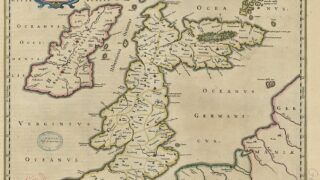


大英図書館(British Library)は、十六世紀から1824年の間に作成された4万点におよぶ地図・図像資料コレクションのうち第一弾として18,000点をパブリックドメインとして公開したことを発表した。
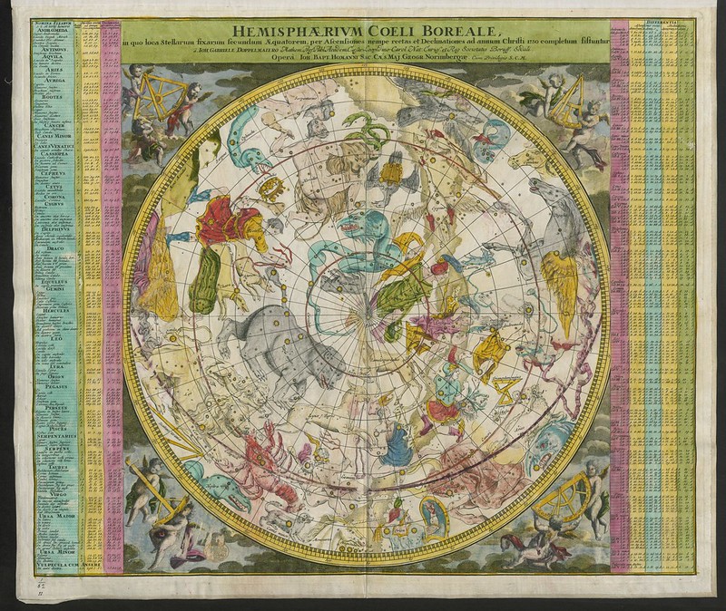
“Hemisphaerium Coeli Australe (Boreale), in quo loca Stellarum fixarum secundum Æquatorem, per ascenciones ad annum 1730 completum, sistuntur, a J.G. Doppelmaiėro; operâ J.B. Homanni.” / Maps K.Top.1.62.
大英図書館の公式Flickr、または、Flickrの” georgeiiitopographicalcollection”タグから一覧表示・ダウンロードできる。
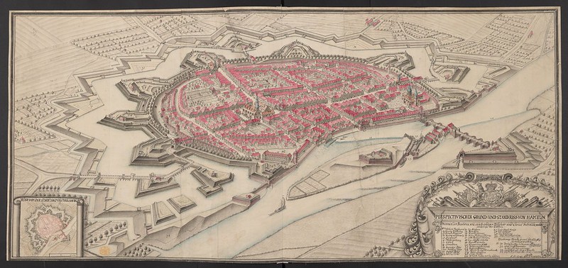
“PERSPECTIVISCHER GRUND UND STAND RISS VON HAMELN ” / Persson, Carl Friedrich / Maps K.Top.100.67.
今回公開された資料は英国王ジョージ3世(1738-1820)治世下でまとめられた「王の地形学コレクション” The King’s Topographical Collection (K.Top)”」である。1660年代から収集が開始され、1760年代以降国王の司書や代理人によって大幅に追加された。
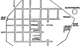
“A wide variety of material is incorporated, including globes; manuscript and printed atlases; architectural drawings and garden plans; maps and records of military campaigns, fortifications, barracks, bridges and canals; records of town and country houses, civic and collegiate buildings; drawn and printed records of antiquities including stained glass, sculpture, tombs, mosaic pavements and brasses; and thousands of drawn and printed views.”
(地球儀、写本や印刷された地図、建築図や庭園設計図、軍事作戦・要塞・兵舎・橋・運河の地図や記録、都市や田舎の家、市民や大学の建物の記録、ステンドグラス・彫刻・墓・モザイク舗装・真鍮などの古代美術品の図面や印刷された記録、そして何千もの図面や印刷された景色など、多種多様な資料が含まれている。)
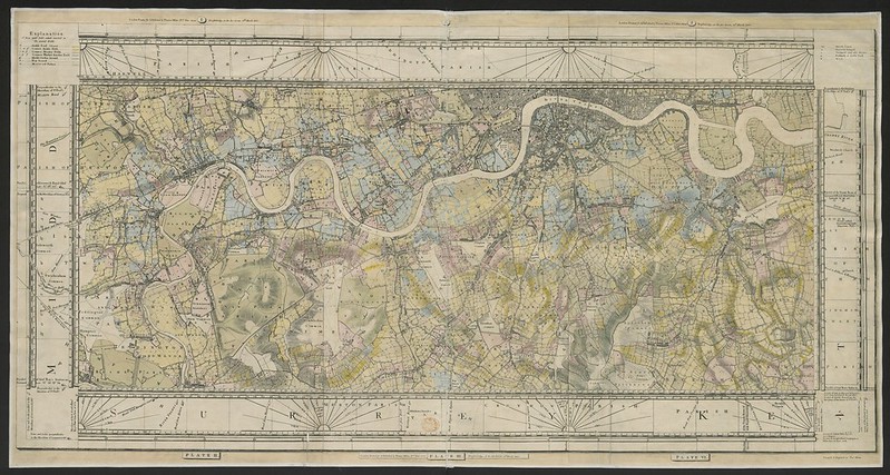
“Milne’s Plan of the Cities of London and Westminster, circumjacent Towns and Parishes &c, laid down from a Trigonometrical Survey taken in the Years 1795-1799. ” / Milne, Thomas/ Maps K.Top.6.95.
1823年、王の司書フレデリック・バーナードによって整理・目録が作成された後、英国王ジョージ4世(1762-1830)によって大英博物館に寄贈され、1973年、大英図書館の設立にともない引き継がれた。
十六世紀から十九世紀にかけての地図資料という特徴ゆえに、これらの資料は帝国主義と深いかかわりがある。大英図書館はプレスリリースで「この資料が公開されることで、研究が促進され、過去のこれらの側面の理解が深まることを願っている」という。このような意義から今回のデジタル化を実現するために七年の歳月がかけられた非常に大きなプロジェクトである。

“Exactissima Asiæ Delineatio, in Præcipuas Regiones, Cæterasqe Partes divisa, et denuo in lucem edita per Carolum Allard. ” / Witsen, Nicolaas / Maps K.Top.114.7.
地図は大英図書館が提供するインタラクティヴなアプリケーション「Georeferencer」でも利用できる。
Georeferencer解説動画
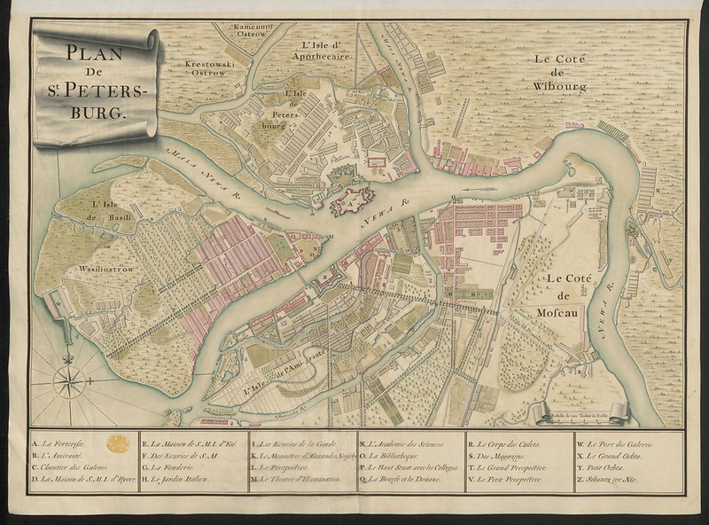
Maps K.Top.112.75.” width=”800″ height=”592″ class=”size-full wp-image-23953″ /> “Plan de St. Peters-burg.” / Maps K.Top.112.75.
!["[The Prospect of their Ma'ties Castle of Sterling]." / Slezer, John / Maps K.Top.50.96.e.](https://call-of-history.com/wp-content/uploads/2020/11/50263334563_237633e83d_c.jpg)
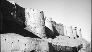
“[The Prospect of their Ma’ties Castle of Sterling].” / Slezer, John / Maps K.Top.50.96.e.
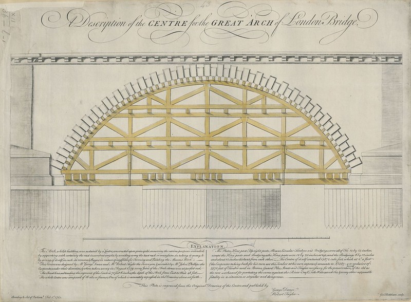
“Description of the CENTRE for the GREAT ARCH of London Bridge. ” / Bickham, George / Maps K.Top.22.36.l.1.
ニュースソース
“The K.Top: 18,000 digitised maps and views released – Maps and views blog”
“What is K.Top? | British Library – Picturing Places – The British Library”
“40,000 early modern maps now freely available online – Medievalists.net”
“King’s Topographical Collection – The Topographical Collection of George III contains drawn and printed maps, views and atlases produced between 1500 and 1824.“(FlickrのKing’s Topographical Collectionページ)

